


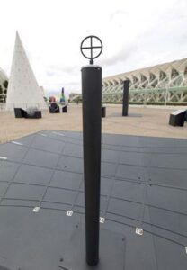
 The gnomon is probably the world’s oldest and simplest astronomical instrument: a simple vertical bar perpendicular to the ground which projects the sun’s shadow onto a horizontal plane. ‘Gnomon’ is a Greek word meaning stick or cane. We can use this simple device to observe how the gnomon’s shadow moves and how its length varies from season to season.
The hyperbolas that have been marked on the floor represent the trajectory of the gnomon’s shadow throughout the day and for the different seasons. The curve that is closest to the gnomon corresponds to the path traced by the shadow during the summer solstice, that is, when the Sun’s position above the horizon is at its highest. This explains why this shadow is the shortest. The longest shadow, by contrast, corresponds to the winter solstice, when the Sun’s position is at its lowest.
A gnomon can also be used as a calendar or sundial. The prolongation of each line towards the East and West indicates where the Sun rises and sets over the course of a year. This point on the horizon corresponds to these cardinal points (East and West) at the equinoxes, when night and day are of equal length. The path traced by the gnomon’s shadow at equinox is not a hyperbola, but a straight line.
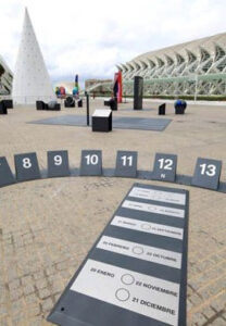 You don’t need anything to tell what the solar time is. Your body is all you need. In this activity you will be the gnomon; your shadow will indicate the solar time.
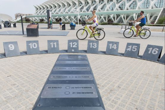
Don’t worry if your shadow does not reach the numbers of the sun dial; you can extend the shadow line by holding your arm above your head. On this type of horizontal clock, the hours are marked on a large ellipse, whose major axis is oriented in the East-West direction. The plaque situated in the centre on the minor axis of the ellipse shows the months of the year.
To make a correct reading, you need to stand on today’s date and your shadow will indicate the time. Stand on the central plaque and look for today’s date. What time does your shadow indicate?
You don’t need anything to tell what the solar time is. Your body is all you need. In this activity you will be the gnomon; your shadow will indicate the solar time.
Don’t worry if your shadow does not reach the numbers of the sun dial; you can extend the shadow line by holding your arm above your head. On this type of horizontal clock, the hours are marked on a large ellipse, whose major axis is oriented in the East-West direction. The plaque situated in the centre on the minor axis of the ellipse shows the months of the year.
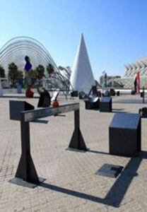
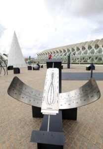
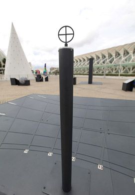
To make a correct reading, you need to stand on today’s date and your shadow will indicate the time. Stand on the central plaque and look for today’s date. What time does your shadow indicate?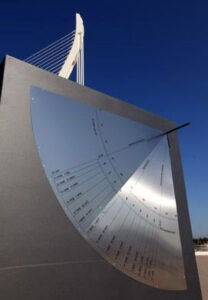 This instrument is a plinth. It was described by Claudius Ptolemy in the second century A.D. and was used to measure the maximum altitude of the Sun above the horizon. At noon, at the highest point of its trajectory, the Sun crosses the meridian of the place of observation.
This altitude depends on the latitude, and also varies throughout the year; maximum altitude occurs during the summer solstice and the minimum altitude occurs during the winter solstice. At the latitude of Valencia, the maximum altitude reached by the Sun during summer solstice is 73º 57’; during the winter solstice it only reaches 27º 5’.
If you look at the shadow of the indicator rod at 12:00 solar time, you can obtain the solar declination for today’s date.
The declination is the angle between the Sun and the celestial equator. As the declination of the sun varies according to the day of the year, the plinth can also be used as an accurate annual calendar –but only at exactly solar noon.
The plinth can be used to determine when the solstices and equinoxes will occur. To do so, all you need to do is read off the mark indicated by the shadow at solar noon.
 The Sun’s position changes over the course of a day, but over longer periods of time as well; from month to month, for example. This movement is the reason why there are solstices and equinoxes—the topic of this module.
Lie down on the platform and place your head in the depression at the top. Observe the equinox and solstice lines. From this position, the winter solstice line represents the path of the Sun on the shortest day of the year. The Sun rises much later and is farthest from the East. At noon, the sun is relatively close to the horizon; its rays are oblique which means that the heat energy from its rays is weaker.
As winter progresses, the elevation of the Sun increases. On the day when the vernal equinox occurs, the Sun rises exactly due East, and follows the line traced by the central circumference. Day and night last an equal length of time (12 hours), which gave rise to the term ‘equinox’, which is derived from the Latin word aequinoctium, or ‘night equal (to day)’. As spring progresses, the Sun rises earlier and sets later each day until the summer solstice, when there are more hours of daylight.
On this day the Sun’s trajectory follows the upper circumference, the one that is largest.
Over the three summer months that follow, the cycle is reversed: the Sun follows a path that gets shorter each day, until the autumnal equinox. The line traced is identical to that followed in the spring.
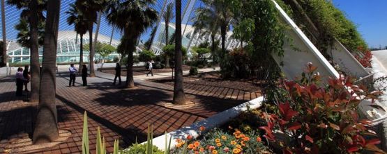
 We see the path taken by the Sun as it travels over the horizon as a great arc that stretches between two points. In this module we will learn about these two points, or where the sun ‘rises’ and the sun ‘sets’, as it is referred to in everyday language.
The phrase “The Sun rises in the east and sets in west” is not entirely true. This is true only twice a year: during the Vernal and Autumnal equinoxes. To determine where these two cardinal points are, you need to observe the sunrise or sunset on one of those days. The only other way is to observe the Sun’s position at noon –when it is at its highest point—this position will indicate south.
Over the course of a year, sunrise and sunset occurs at varying positions over the horizon. In the northern hemisphere, the point at which the Sun sets moves southward in winter. In summer, this position moves northward.
 The movement of the Sun can also be quite useful in determining the time of day. In this exhibit we will look at two Sun clocks and learn the difference between solar time and civil time.
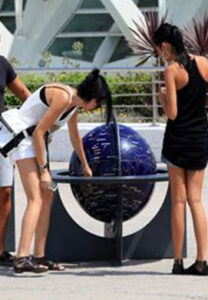
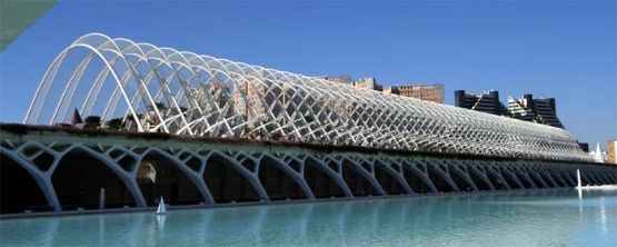
Equatorial Sundial (gallery image 1)
An equatorial sundial is simple, but the time of year must be known when taking a reading. During the spring and summer months, the Sun’s path over the horizon becomes increasingly higher causing its rays to illuminate the upper portion of the clock. However, during the autumn and winter, the Sun’s position is much lower over the horizon and so its rays will illuminate the lower portion of the clock. In both cases, the time is indicated by the style’s shadow on the clock face.
The information obtained from this instrument is known as the solar time, which is not the same as the civil time indicated by a regular clock. To obtain an approximate value for civil time, you need to take the solar time observed on the sundial and add one hour in winter and two hours in summer.
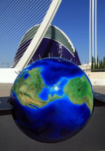
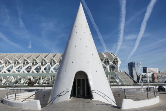
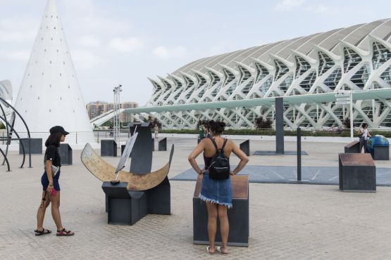
Corrected Equatorial Sundial (main image)
We can use the corrected equatorial sundial to obtain both the solar time and civil time; that is, the time indicated by a regular clock. This correction takes into account the date and the latitude of the place of observation. To do so, the gnomon is substituted by a mobile plate containing a special symbol in the shape of an eight. This symbol is called the analemma, which has been calculated for Valencia. It describes the Sun’s position in the sky throughout the year.
 Up until now we have talked about the portion of Earth that is illuminated by the Sun. But when one side of the planet is experiencing day, the opposite side is in darkness. For this portion of the Earth, it is night-time. A globe is a model of the Earth. It gives us a visual representation of the rotation of the Earth and the effects caused by this movement.
Can you identify which half of the Earth is experiencing day and which is experiencing night? Like the Earth, the North Pole of this model is oriented towards the North Star; that means that its axis is parallel to that of the Earth. Therefore the area of the globe that is in darkness is experiencing night and the area of the globe that is illuminated by the Sun’s rays is experiencing day.
The first person to calculate the Earth’s dimensions was Eratosthenes (a Greek scholar born in Cyrene [present-day Libya] more than 2,200 years ago), who did so by measuring the shadow cast by two obelisks located in two different cities: Alexandria and Syene, or modern-day Aswan.
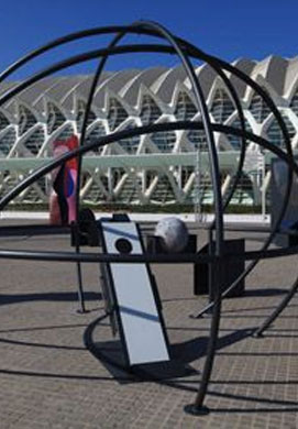
 In the Astronomy Garden you will be able to observe the movement of stars other than the Sun.
When we look up into the sky on a clear night, the Earth’s rotation around its axis makes it appear as though the stars are rotating slowly around us in an east to west direction. If you set the sphere’s axis to the 39º mark, which is the approximate latitude of Valencia, you will be able to observe the apparent movement of the celestial sphere by simply rotating the sphere from east to west.
Curiously there are some constellations which never disappear below the horizon and are visible throughout the entire night. These are known as circumpolar stars because they appear to rotate around the celestial pole. In the northern hemisphere, the celestial pole corresponds to the Northern Star. If you change the latitude of the sphere, you will see that the night sky also changes with respect to the place of observation.
On the equator, the paths taken by the Sun, Moon and stars as they rise and set are approximately perpendicular to the horizon. You can observe this phenomenon by setting the rotational axis to 0º, which is the latitude at the equator, and then rotating the sphere.
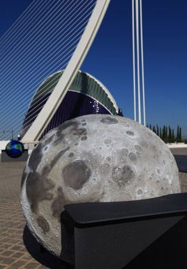
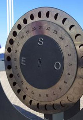
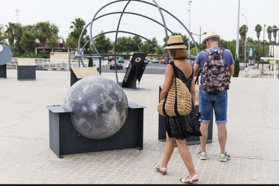
 The third celestial body featured in the Astronomy Garden is the Moon—the Earth’s natural satellite. In addition to captivating the observer with its curiously cratered surface, the moon can also be used as a real clock.
People usually think that celestial objects can only be seen during the night, but there are times when we can see the Moon during the day. As it approaches its new moon phase, it rises in the morning and sets at the end of the day. When it is close to its full moon phase, the moon rises at sun down and sets at dawn.
The third celestial body featured in the Astronomy Garden is the Moon—the Earth’s natural satellite. In addition to captivating the observer with its curiously cratered surface, the moon can also be used as a real clock.
People usually think that celestial objects can only be seen during the night, but there are times when we can see the Moon during the day. As it approaches its new moon phase, it rises in the morning and sets at the end of the day. When it is close to its full moon phase, the moon rises at sun down and sets at dawn. Even a quick look at the moon’s surface reveals light and dark areas. The lighter surfaces are known as ‘terrae’ (from the Latin for earth), and the darker surfaces are known as ‘maria’ (from the Latin for sea). Early astronomers believed that the latter were oceans. Although later on astronomers realised that there wasn’t any water on the moon, the name remained. The lighter areas, or the so-called continents, are also commonly referred to as lunar highlands due to their higher altitude.
The distribution of these two surface types differs from one face of the Moon to the other. Whereas nearly one third of the near side of the Moon is covered by ‘seas’, these represent only 2% of the surface of the far side of the Moon. But how did these physical structures form?
Approximately 3.8 billion years ago, the Moon’s crust was heavily bombarded by asteroids, creating numerous impact craters with diameters hundreds of kilometres wide. These craters were subsequently filled by lava, forming oceans of molten rock. As they cooled, they formed the ‘seas’ that we see today. Craters account for the majority of the Moon’s surface features. In fact, there are approximately 30,000 craters with a diameter greater than 1 kilometre on the near side of moon, and countless more that are smaller.


